Multi-Dimensional Data Visualization in TransimsVIS
Great strides forward have been made during this quarter for TRACC's Multi-Dimensional Data Visualization task. Central to this is a completely new application which is a re-imaging of the TransimsVIS software. Tentatively named TransimsVIS 2.0, this tool aims to effectively integrate the best features and concepts of the original TransimsVIS with those of the Metropolis software. Similar to TransimsVIS, the tool is region-oriented with strong abilities to display and analyze large areas along with geo-coded information such as satellite images. The concepts borrowed from Metropolis include: extremely high performance and interactivity as well as clean and effective graphics. The project has made a great amount of progress despite the inherent difficulty of the C++ framework and starting from scratch. The application now includes the following features: network drawing, 3D navigation, web-based satellite imagery, a new compression algorithm, vehicle drawing, and temporal advancement. In addition to the work done on TransimsVIS 2.0, the TransimsEDT software has been expanded. It now includes a sophisticated transit editing suite with features such as: automatic route correction, route fidelity checking, route addition/deletion, algorithm-assisted transit route building, and a route organization/categorization tree.
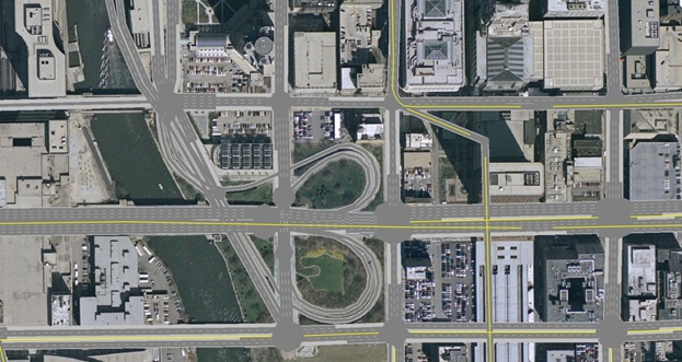
High Quality Road Network Drawing Algorithm in TransVIS
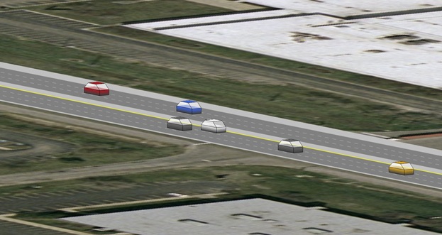
Basic 3D Vehicle Models in TransVIS